
Description
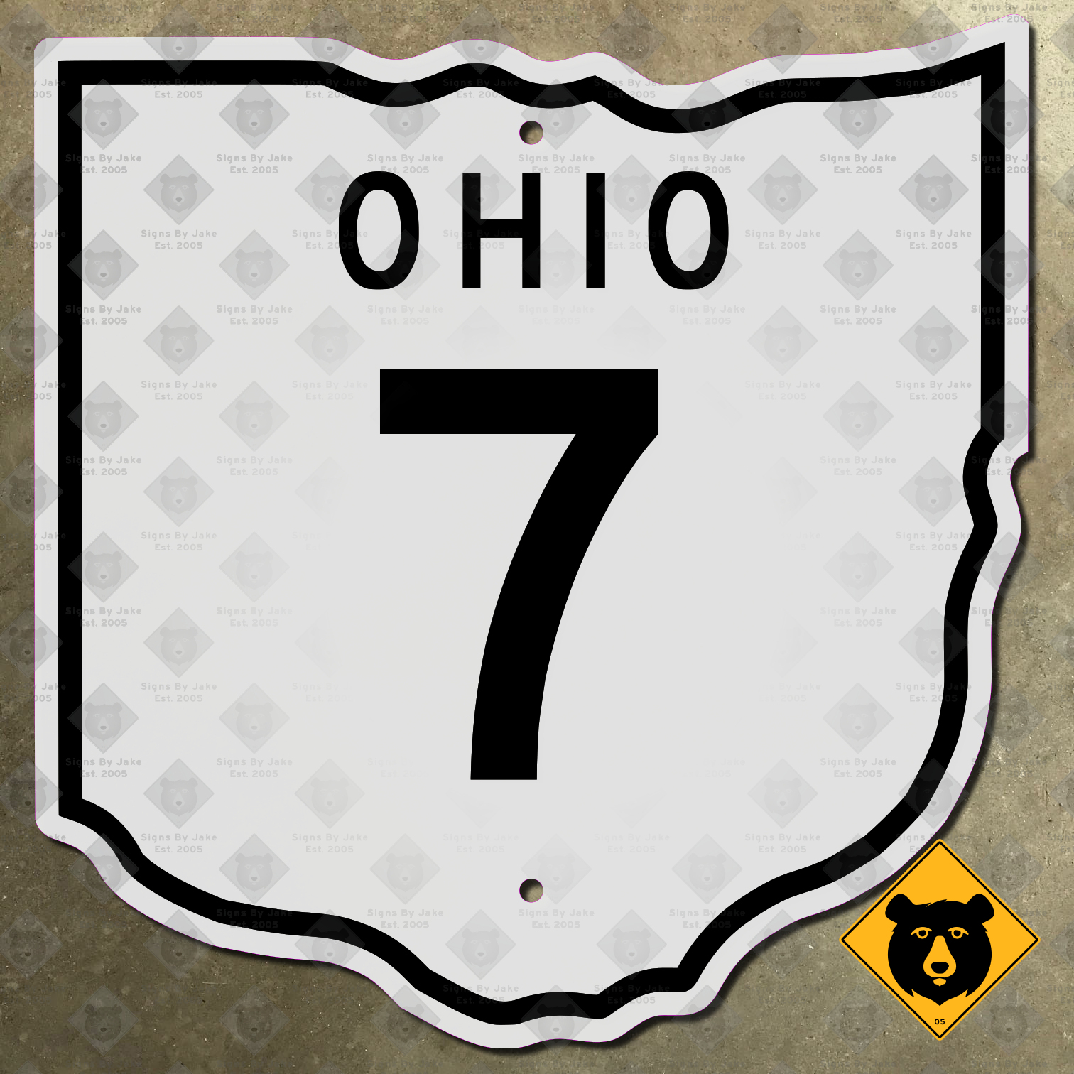
State Route 7 is the longest state route in Ohio. It begins at the state’s far southern tip, near the town of Chesapeake. From there, it heads northeast along the Ohio River, the state’s border with West Virginia, then proceeds north along the border with Pennsylvania. It ends in Conneaut, along Lake Erie, in Ohio’s northeastern corner. Along the way it serves two of the largest cities in eastern Ohio, Youngstown and Steubenville.
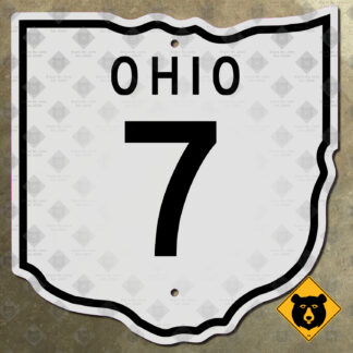
We’ve made our Ohio State Route 7 marker according to the exact 1952 specifications used along this highway. This design, which was in use for only ten years, features the number and state name on a panel cut out in the shape of Ohio. Our sign uses a precise replica of the Ohio outline used, as well as completely accurate fonts. Getting an original Ohio State Route 7 marker like this one is difficult. Due to their short time in service, any surviving examples are likely to command a handsome sum on the private collectors’ market—in the rare event one turns up, that is! Avoid the uncertainty and save money with our replica route marker. It’s the perfect addition to any collection of mid-century Midwestern transportation memorabilia.
Our sign is flat printed on 14-gauge steel, with two mounting holes included for your convenience. It’s durable enough to withstand the elements outside, while its non-reflective face also makes it perfect for display inside. We’ve made it available in two sizes: 11 13/16 in. × 9 3/4 in., as well as the original 15 3/4 in. × 16 7/16 size. (Want a marker like this with another number, or in a different size? We’re happy to customize any of our signs to your needs! Just contact Jake to get started.)

Reviews
There are no reviews yet.